A Study of the Arkyd-6 SmallSat
By Jon Engelsman
February 20, 2018
A look at the Arkyd-6 satellite from Planetary Resources.
 Planetary Resources
This post is a dive into the Arkyd-6 technology demonstration satellite from Planetary Resources. With recent news of their successful launch and deployment of Arkyd-6A in late January 2018, I wanted to explore a satellite and a company that I’ve had my eye on for a while now!
Planetary Resources
Planetary Resources is a Seattle-based company with a mission to develop the “world’s first commercial deep space exploration program” with a purpose to “identify and unlock the critical water resources necessary for human expansion in space”.
 Infographic Labs/Planetary Resources
Originally founded in 2010 as a Arkyd Astronautics Inc by a trio of space industry veteans (Peter Diamandis, Chris Lewicki, and Chris Anderson), it has grown to over 70 employees and has built and successfully deployed two small satellites into Low-Earth Orbit (LEO).
Planetary Resources currently has a three step mission to achieve their deep space exploration mission of finding water on near Earth asteroids. These missions involve building and deploying progressively more advanced satellites, first into Earth orbit and eventually farther out into space. The first two of these missions have arguably been completed, with the launch and deployment of the Arkyd-3 and Arkyd-6 technology demonstrators.
The third mission, planned for 2020, involves launching multiple Arkyd-301 spacecraft for asteroid rendezvous and data collection.
Previous plans for intermediate Arkyd-100 and Arkyd-200 spacecraft seem to no longer be in development. Following a Series A funding round in 2016, Planetary Resources had announced plans for the development of an earth observation network which likely would have been made up of Arkyd-100 satellites. However, an announcement in June 2017 cancelled plans for that system, likely ending development of the Arkyd-100 platform.
Arkyd-3R
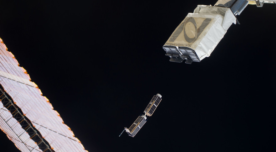
Planetary Resources’ first mission was completed in mid-2015 with the successful launch of their Arkyd-3R technology demonstrator CubeSat on the SpaceX CRS-6 mission to the International Space Station (ISS), with subsequent deployment by a NanoRacks CubeSat Deployer.
 Nanosats Database
The Arkyd-3R was built as a technology demonstrator to prototype the mostly in-house development of a 3U CubeSat platform, with no specific instrumentation package on-board.
 SpaceNews/NASA
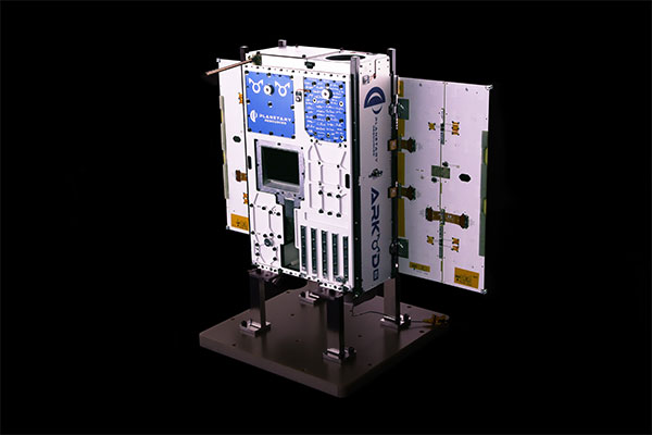
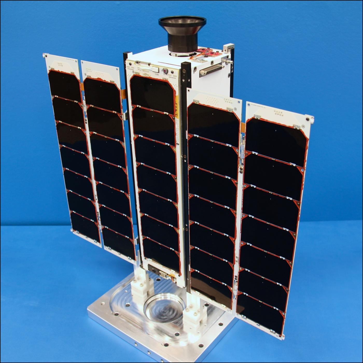
Arkyd-6
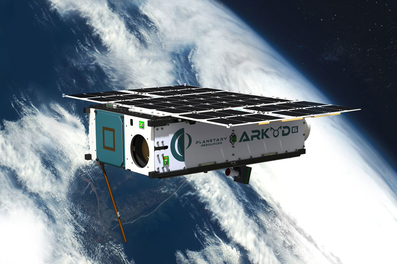
The second mission was kicked off in late January 2018 with the successful launch of their new Arkyd-6 CubeSat. Twice as big as the Arkyd-3, the 6U Arkyd-6 platform is an iterative improvement on its predecessor’s technology and, with its larger size, is intended to host various experimental payloads and instrument packages.
 Planetary Resources
The first of possibly two Arkyd-6 launches, the Arkyd-6A satellite was launched in January 2018 onboard an Indian Polar Satellite Launch Vehicle (PSLV) rocket. According to their 2015 Commercial Remote Sensing Regulatory Affairs (CRSA) license with NOAA, Planetary Resources had plans for two Arkyd-6 vehicles, the Arkyd-6A and Arkyd-6B. Additionally, a filing update with the FCC in June 2017 indicates that the Arkyd-6B satellite was actually intended to be launched first, in October 2017 on-board another PSLV launch. But that launch does not appear to have occurred, and the launch plan for the Arkyd-6B is unknown.
Arkyd-6 Instrumentation Payload
The primary payload of Arkyd-6A is a medium-wavelength infrared (MWIR) detector with a spectral range of 3.4-5.1 µm. This region of the electromagnetic spectrum is specifically relevant to Planetary Resources’ overall mission because of its sensitivity to the presence of water and thermal energy, a crucial capability in scanning asteroids for valuable resources.
From its Sun-Synchronous Orbit (SSO) of roughly 500 km, Arkyd-6A and its MWIR detector will have a Ground Sampling Distance (GSD) resolution of ~30 meters. According to Planetary Resources, their technical team “qualified a commercial sensor to collect pixel-level data and integrated custom optics, creating the world’s first commercial MWIR instrument to be used in space”.
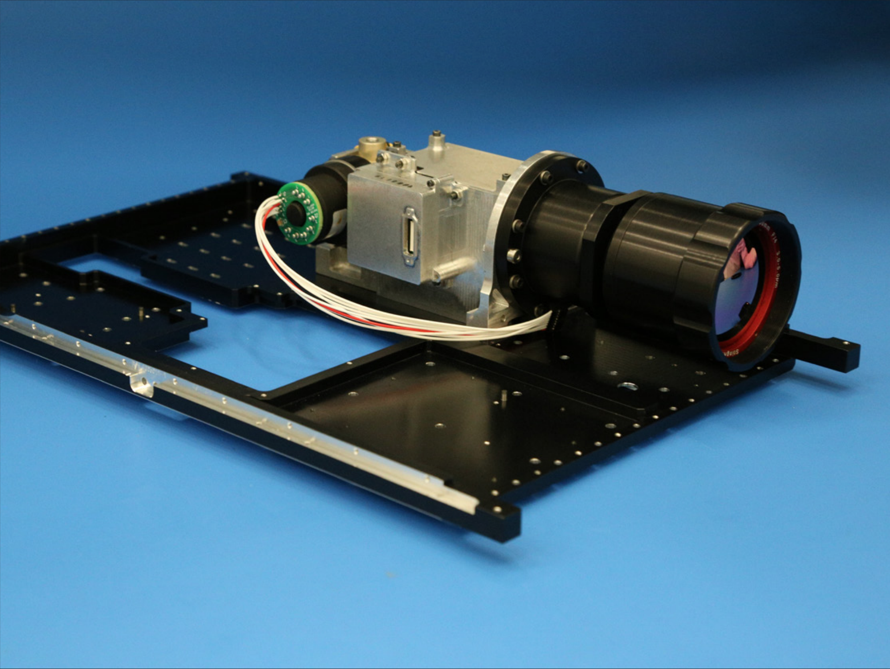
A May 2016 presentation shows the layout of the 6U CubeSat without the MWIR instrumentation package.

However, an August 2016 paper presented at the 30th AIAA/USU Conference on Small Satellites not only shows the MWIR detector, but also provides additional information on the technical specifications, development and validation of the instrumentation assembly.
The MWIR instrument consists of two primary components: an Integrated Detector Cooler Assembly (IDCA) and an optical lens. However, it looks like two different IDCA and lens combinations were tested, based on a comparison of two photos from the MWIR paper.
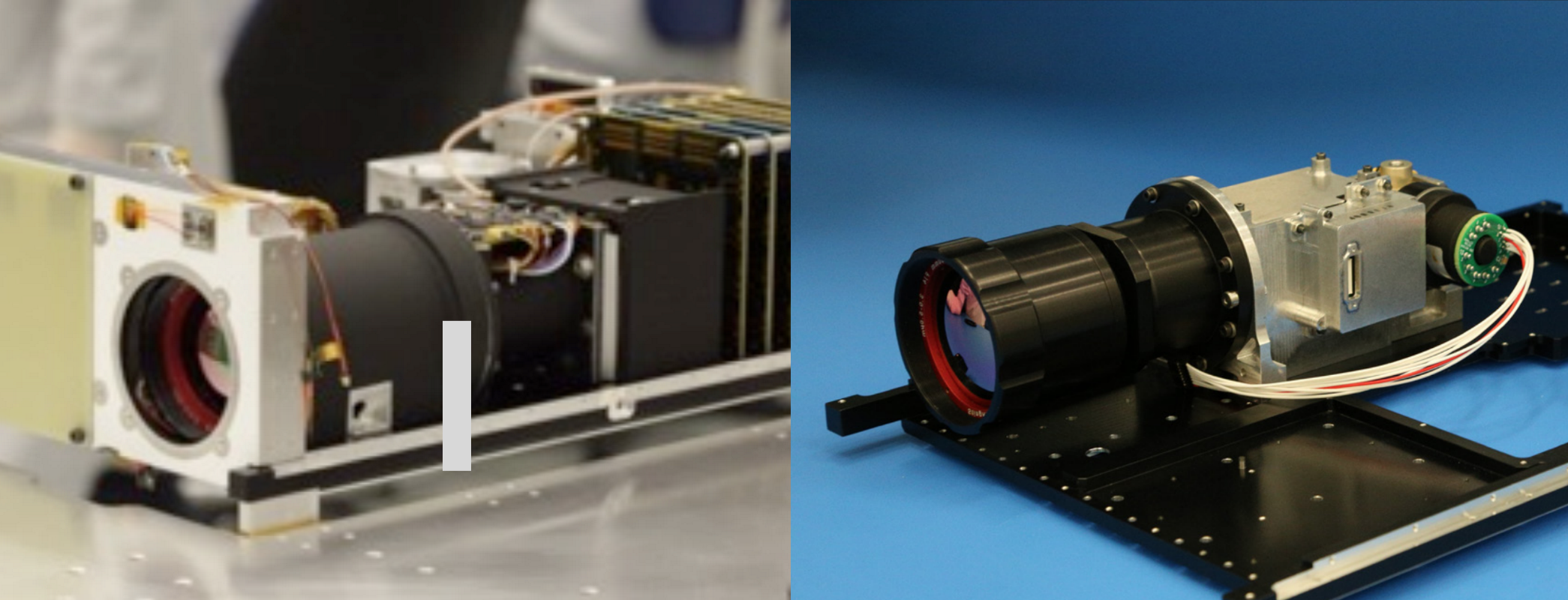
Both the lens barrel and the IDCA housing look different in the two photos, so it’s unclear which version was actually flown on the Arkyd-6A launch. Note that the image on the right has been flipped horizontally for a better comparison of the lens barrel, which is why it appears to be on the opposite side of the baseplate.
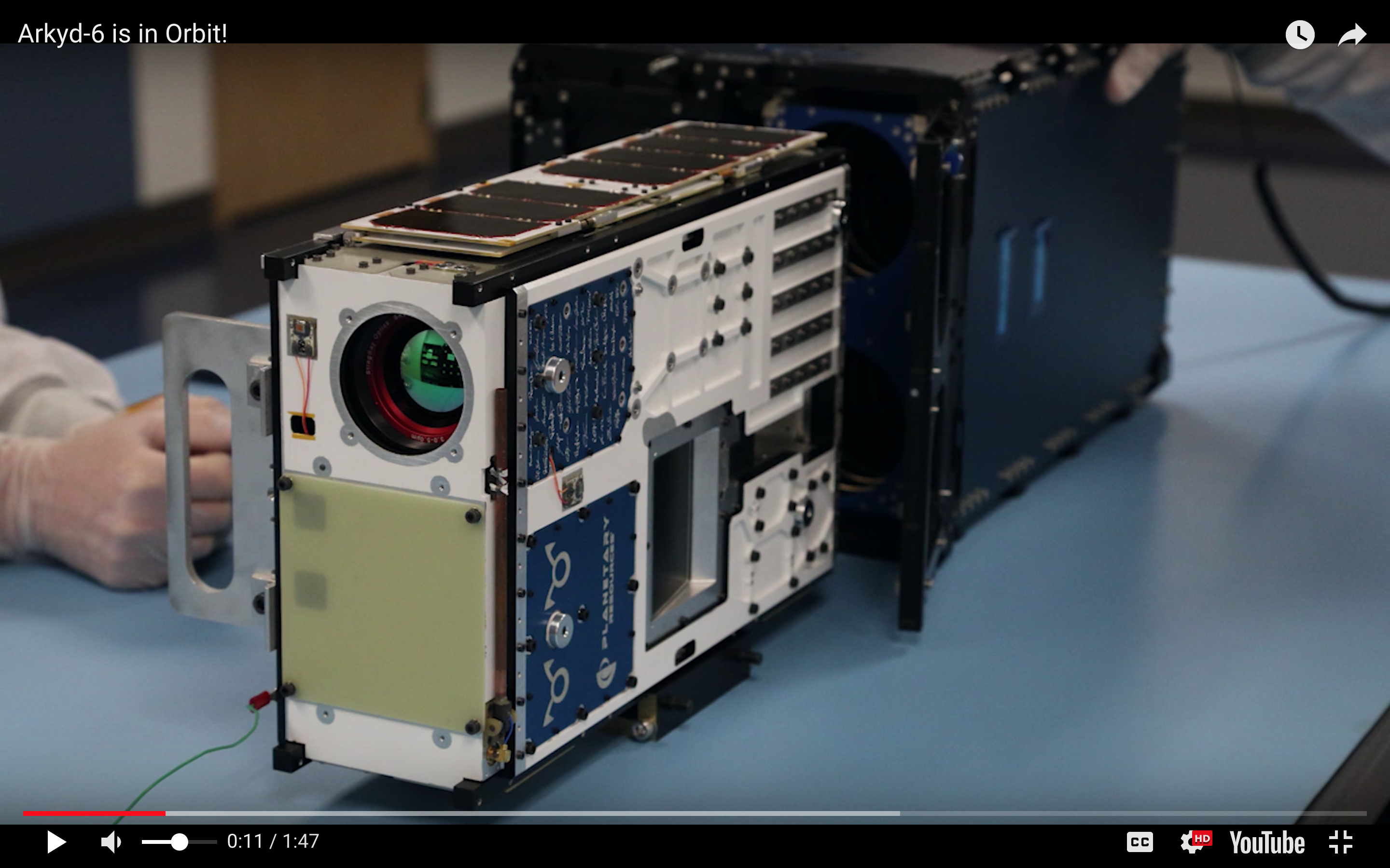
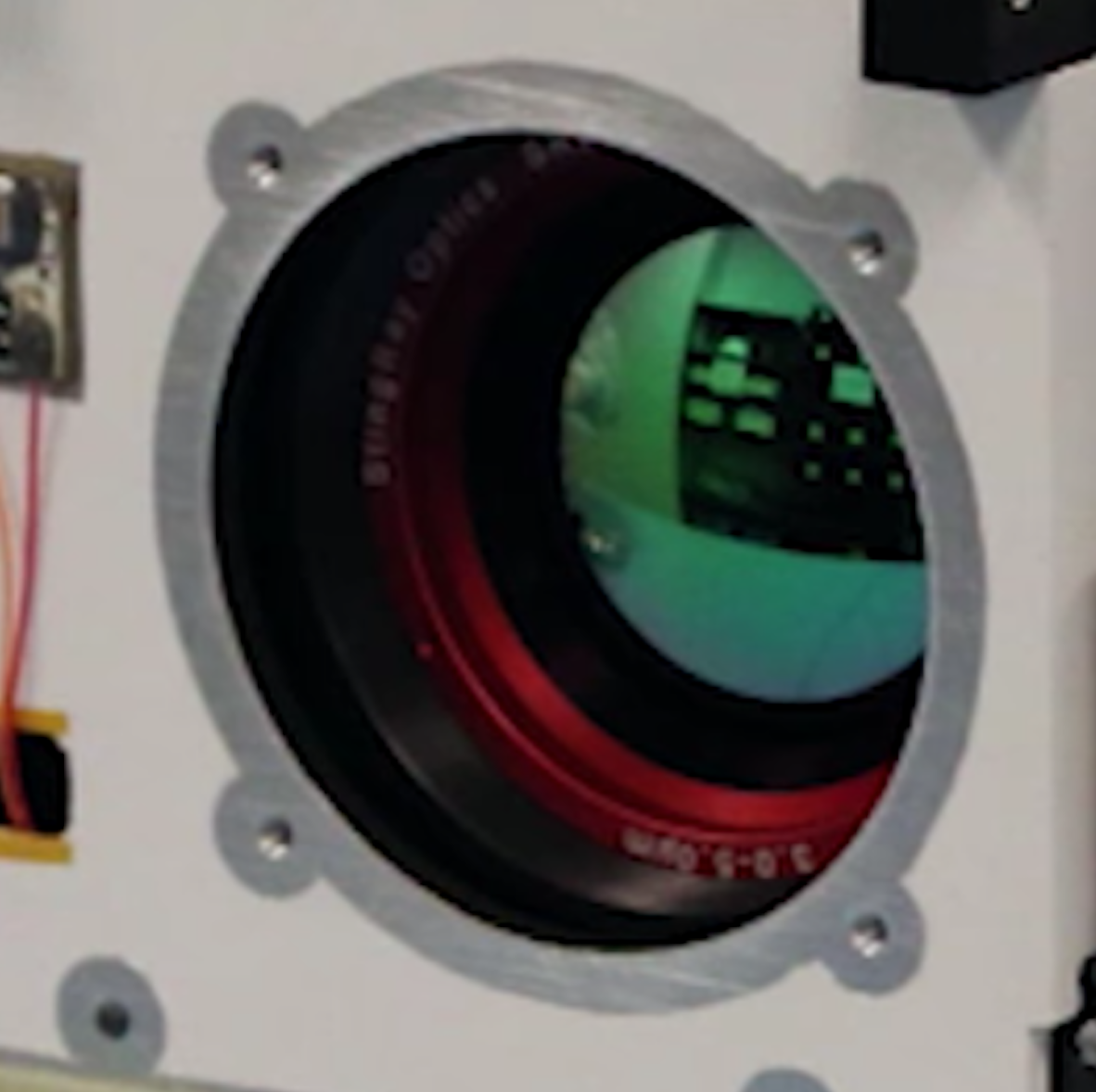
Also, a video screenshot of the CubeSat’s exterior housing shows the front of the lens.
And zooming in, we can see that the lens is stamped with “ StingRay Optics”, which is an infrared lens manufacturer based in New Hampshire, founded in 2004.
Based on the images available, it’s unclear what brand IDCA is being used but it’s most likely a custom packaged IDCA (e.g. IRCameras).
Mission Operations and Telemetry
About a week after launch, Planetary Resources announced that they had begun receiving telemetry from the Arkyd-6A spacecraft. In an update a couple days prior to the launch, Planetary Resources described their mission operations as follows:
“In our Mission Operations Center, we will be planning activities for our upcoming passes, executing those passes from our ground station, and reviewing spacecraft telemetry. During a pass, we will prescribe a set of commands to be transmitted to the spacecraft to accomplish specific actions such as uplinking communication windows, turning the spacecraft to a specific attitude, or downlinking the next mid-wave infrared image.”
A YouTube video posted in November 2017 describes Planetary Resources building out their antenna communications setup on the roof of their building in Redmond, Washington.
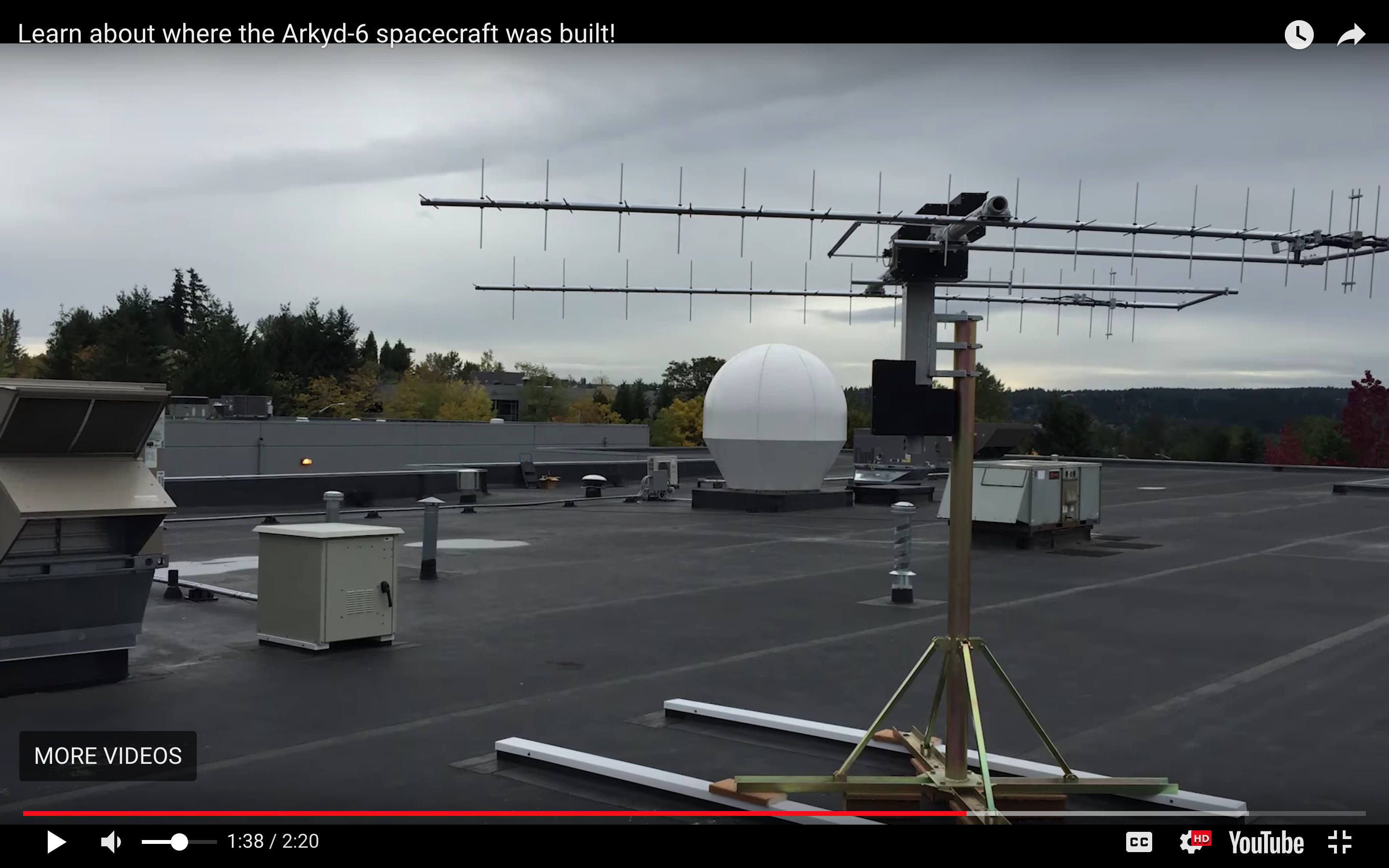
And satellite imagery of the Planetary Resources offices show the addition of at least two different antenna structures, which appear to match the communications setup shown in the video above.

Also of note, an FCC license filing from January 10, 2018 (two days before the launch of Arkyd-6A) shows a temporary 60-day license provided to RBC Signals for providing “tracking, telemetry and command services” from a ground station in Deadhorse, Alaska. Most likely, this is referring to the Alaska Satellite Facility, a university-run ground station for remote-sensing satellites and part of NASA’s Near Earth Network (NEN).
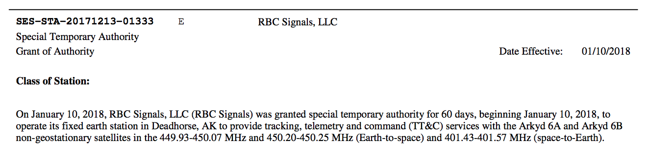
Presumably, Planetary Resources has contracted with RBC Signals to provide supplemental communications support for their Arkyd spacecraft. RBC Signals is an “infrastructure-as-a-service” company that can facilitate ground-based communications for satellites through a group of ground station partnerships. It was co-founded in 2015 by Chris Richins, a former VP of Business Development at Planetary Resources and is also headquartered in Redmond.
So What Are They Going to Do With the Arkyd-6?
Infrared (IR) imaging from space-based remote sensing platforms serves an important role in atmospheric, agriculture and oceanographic sciences as well as natural disaster recovery and many other applications. Some well known satellite-based IR instruments include the Moderate Resolution Imaging Spectroradiometer (MODIS) onboard NASA’s Aqua and Terra satellites, the Thermal Infrared Sensor (TIRS) onboard the USGS Landsat 8 satellite, the Infrared Imaging System (IIS) on Korea’s KOMPSAT-3A, and the commercially-owned WorldView-3, DigitalGlobe’s flagship satellite, providing high-resolution short-wavelength infrared (SWIR) imaging.
The Arkyd-6A MWIR imagery will have a ground sample distance (GSD) of roughly 30-70 meters, putting its imagery resolution on par with the 30-meter SWIR/LWIR imagery from Landsat 8, but well below the 7.5-meter SWIR imagery from WorldView-3 or even the 5.5-meter MWIR imagery from KOMPSAT-3A.
 Digital Globe
 SI-Imaging Services
In a technical paper on the Arkyd-6 MWIR instrument, Planetary Resources noted that “ground resolutions of 15m per pixel are possible by increasing the size of the spacecraft to a 12U form-factor”, likely referring to the Arkyd-100 platform. However, that platform is likely no longer under development since the announcement that they cancelled a planned earth observation constellation, Ceres.
Overall, the primary purpose of the Arkyd-6 mission is as a technology demonstration, both in evolving their Cubesat design and production, but also in validating the performance of the MWIR instrument in a space environment. It also helps in the development of their data processing chain, communicating with the spacecraft through their telemetry network(s) and processing the imagery data that the satellite sends back.
Remote-Sensing Revenue
In a statement following the launch of Arkyd-6A, Chief Engineer Chris Voorhees said that Planetary Resources “intends to use the Arkyd-6 satellite to capture MWIR images of targets on Earth’s surface, including agricultural land, resource exploration regions, and infrastructure for mining and energy”, with the implication being that the imagery would then be sold commercially.
While the Arkyd-6 mission is primarily intended as a technology demonstration, a February 19th Geekwire article reports on statements from a Planetary Resources spokesperson who said that recent financial challenges have “forced the company to focus on leveraging the Arkyd-6 mission for near-term revenue” by apparently “maximizing the opportunity of having a spacecraft in orbit”.
While it’s clear that Planetary Resources is eager to sell the MWIR imagery that is now being collected by Arkyd-6A, it’s unclear exactly how much revenue they expect to raise from a single satellite. While the MWIR imagery offering is somewhat unique in the commercial remote-sensing industry, imagery in similar infrared bands (mostly SWIR) are freely available at comparable resolutions from government-funded programs like Landsat or Sentinel.
Planetary Resources has likely been trying to find customers with requirements for the MWIR spectral band specifically, but it’s unclear exactly how many of those paying customers are out there. A bullet point on the LinkedIn page of Akshay Patel, former VP of Strategy and Business Development at Planetary Resources who left the company in December 2017, mentions that he had “signed multiple letters-of-interest and pilot program agreements with companies in the agriculture and energy industry for mid-wave infrared earth observation data”. His departure however, just a month prior to the launch of the Arkyd-6A, does not give confidence in the viability of this approach for revenue generation.
Hopefully, Planetary Resources is able to find additional fund-raising opportunities, as well as generate some additional revenue from their Arkyd-6A MWIR imagery. In the short-term, it remains to be seen if they will continue with the planned launch of the Arkyd-6B, originally scheduled for October 2017 according to a previous FCC filing. And in the long-term, ongoing development of the Arkyd-301 platform and future missions out to near Earth asteroids are on the line.
Additional Information
The Arkyd Spacecraft Development Platform
Planetary Resources Overview, July 2012
Presentation by Planetary Resources VP of Global Engagement, Secure World Foundation, May 2016
Planetary Resources YouTube Channel
How To Bring Satellite Data Back Down to Earth