Thoughts 19302
By Jon Engelsman
October 29, 2019
On the inspiration of a whale carcass, the need for minimalist map imagery tools, the anachronism of crypto homesteading and a small bit of upward induced lightning.
If A Whale Falls On the Ocean Floor…
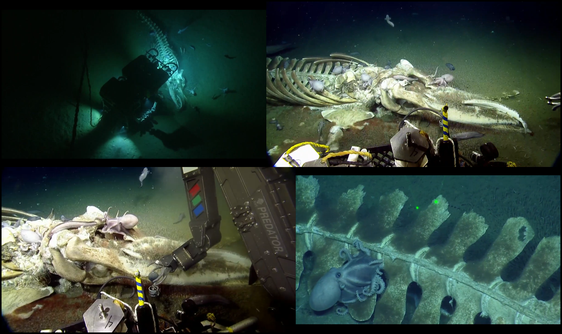
I didn’t know what a “ whale fall” was until I came across this tweet by Ed Yong.
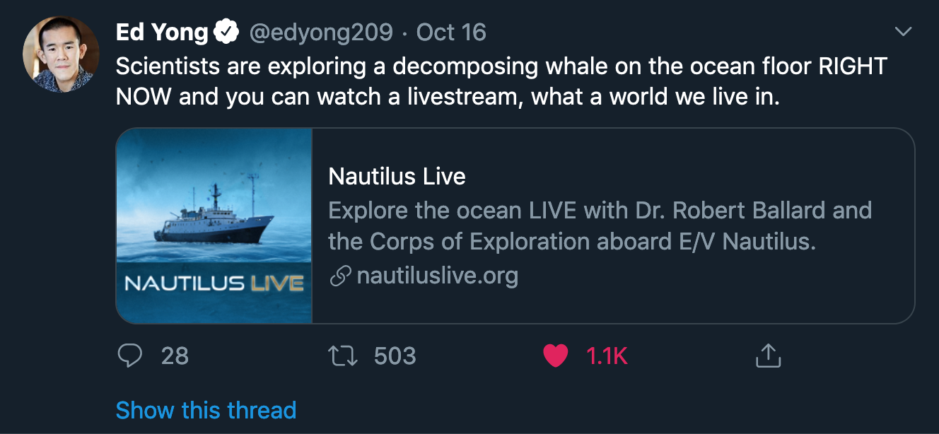
But I soon found myself grossly absorbed watching the undersea exploration of a whale carcass by the E/V Nautilus. The ship apparently stumbled upon the scene about 80 miles off the coast of Monterey, California, near the Davidson Seamount. The crew used two remotely operated vehicles (ROV’s) to explore the whale carcass, taking some scientific measurements and sending back live-stream video to a captive audience on the internet.
Just the Maps Ma’am
Have you ever tried to take a screenshot of satellite imagery in Google Maps? Sometimes you just need some clean map imagery without all of the extra fluff that you typically see in web map interfaces. I’ve been exploring some different options to make my own tools that can be used to capture screenshots of publicly-available web-based satellite imagery (e.g. Google Maps, Bing Maps, Mapbox, etc).
One such option that I’ve put together is a quick and dirty set of JavaScript code that you can run in your browser’s developer console (or in a custom browser plugin) to remove all of the controls and overlays in Google Maps. It takes a heavy-handed approach and just removes a bunch of HTML elements that I’ve found to be the most obtrusive. There’s some mouse click triggers and timeouts to allow most of the elements to load so they can then be removed from the DOM.
- Go to Google Maps: google.com/maps
- Click on Satellite mode
- Navigate to or search for your area of interest in the map
- Open a developer console in your browser
- Copy and paste the code below into the dev console and run it!
document.getElementsByClassName("searchbox-hamburger")[0].click()

setTimeout(function(){

   document.querySelectorAll('[jsaction="settings.intent.labels"]')[0].click();

   setTimeout(function(){

      document.getElementById("omnibox-container").remove();
      document.getElementById("pane").remove();
      document.getElementById("gb").remove();

      document.getElementsByClassName("app-vertical-widget-holder")[0].remove();
      document.getElementsByClassName("app-horizontal-widget-holder")[0].remove();

      var fineprint_container = document.getElementsByClassName("fineprint-container")[0];
      var fineprint_copyrights = document.getElementById("fineprint-copyrights");

      while(fineprint_copyrights.nextSibling) {
         fineprint_container.removeChild(fineprint_copyrights.nextSibling);
      }

      document.getElementById("scale").remove();
      document.getElementsByClassName("widget-minimap")[0].remove();
      document.getElementById("watermark").remove();

   }, 1500);

}, 1500);
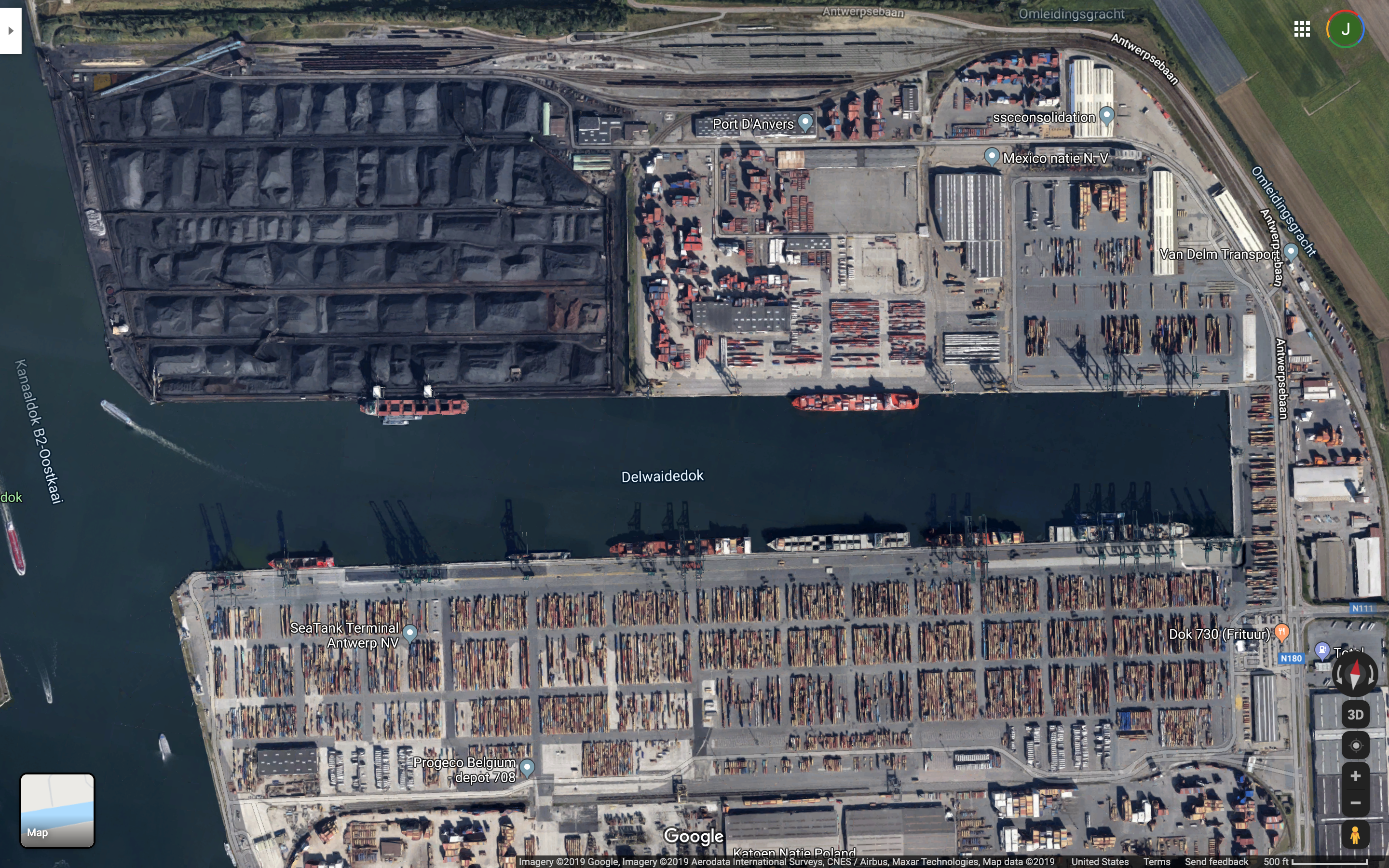
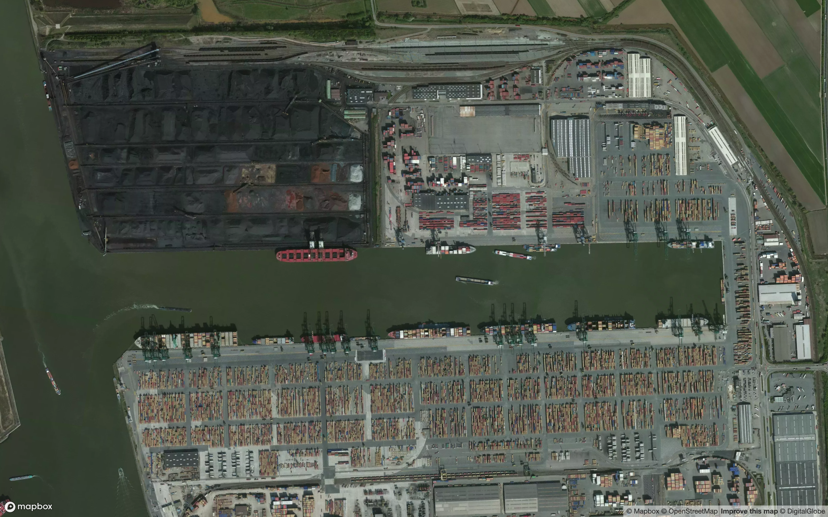
As an example, here’s the port of Antwerp, Beligum with all of Google Map’s overlays, controls and labels:
And here’s a clean version after running the above code:
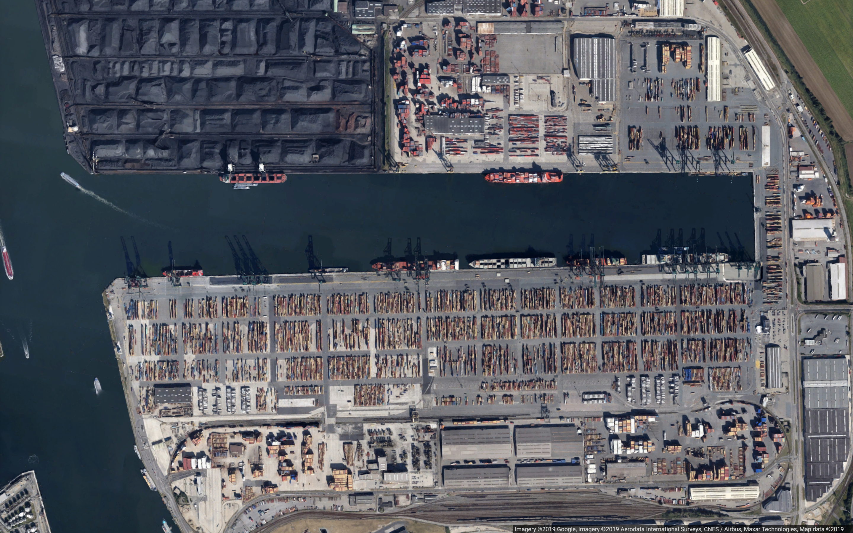
The attribution text is still there in the bottom right but you can always manually remove that if you really want to get rid of it. Either way, you might want to refer Google’s permissions guidelines when using imagery derived from a method like this.
*Screensat
I’ve also starting working on a similar minimalist satellite imagery tool using Mapbox Satellite with the working title Screensat. Same idea, but maybe with some more useful functionality like drawing shapes and adding text for map annotations. Right now, all you can do is toggle the visibility of the geocoder and the attribution text (ctrl-g and ctrl-a, respectively). A work in progress!
Crypto Homesteading
I typically try to stay away from most things cryptocurrency. But an article titled The Crypto Family Farm, by Gabriel Nicholas, about a Washington family and their rural lifestyle based around mining and selling cryptocurrency is mind boggling. It’s a unique mix of techno-dystopia and an oddly anachronistic homesteading vibe. It also somehow evokes a similar feeling of independence and “down with capitalism” that I remember having when I read the original Bitcoin whitepaper.
Also, quick shoutout to Logic, my favorite magazine that has some of the best writing about modern technology issues from a uniquely humanistic viewpoint.
Upward Lightning
Here’s a beautiful mini documentary on storm footage that I came across recently:
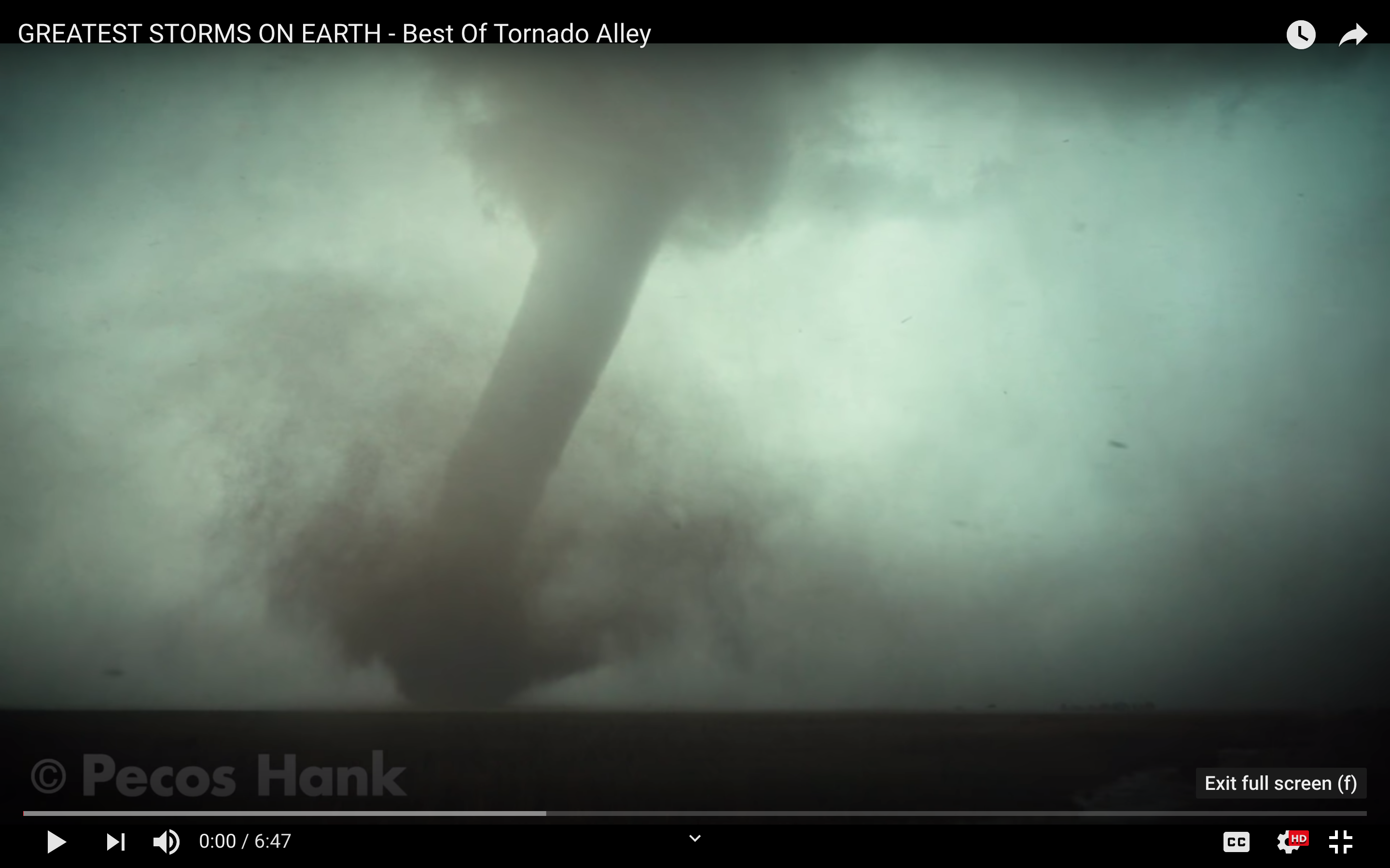
In particular, there was a nice clip of a unique lightning phenomena of which I’m a big fan: upward induced lightning triggered by wind turbines.
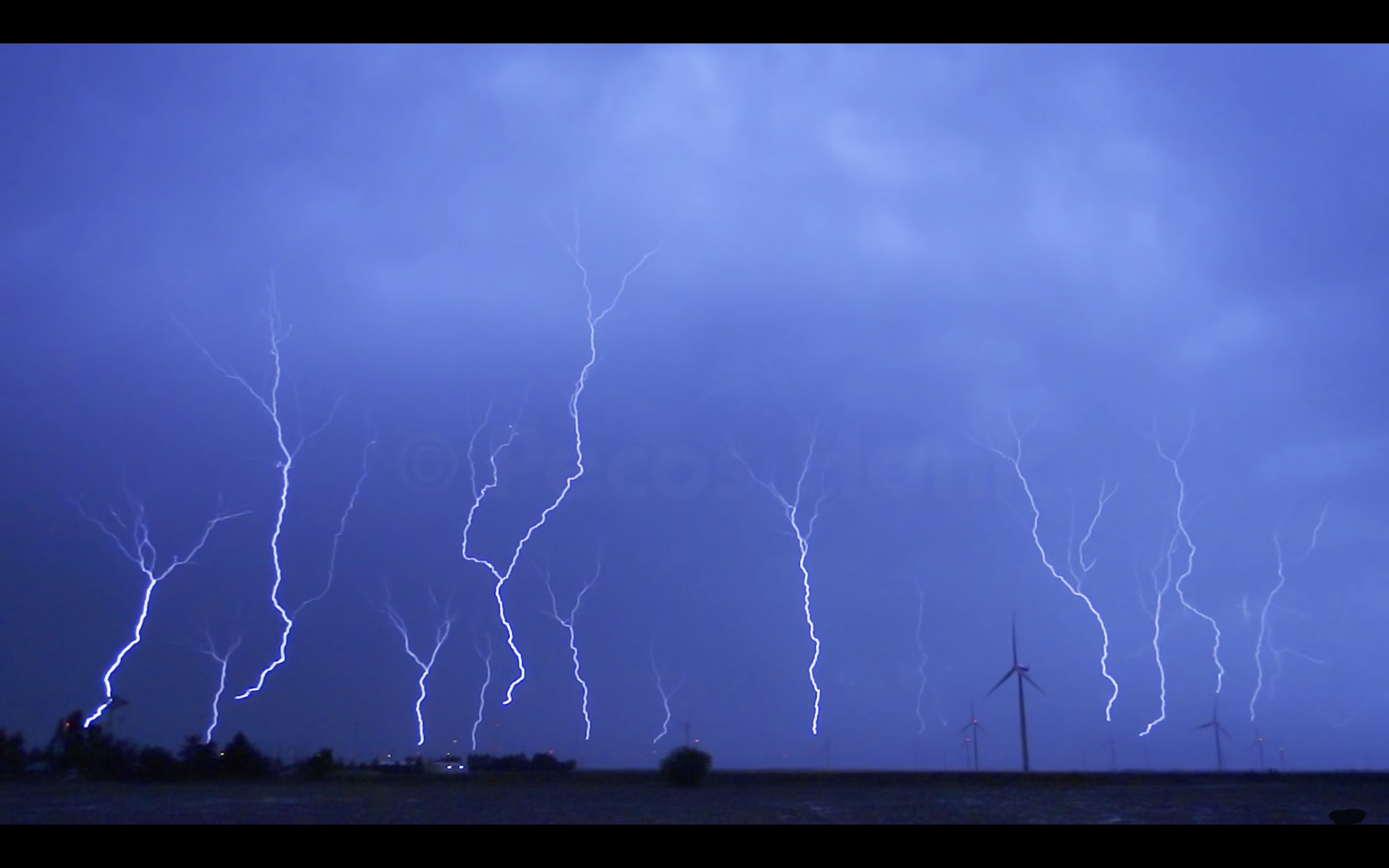
I’ve written a bit about this in the past, but I miss working on lightning issues with wind turbines! Every once in a while, something lightning-related comes up in my news feed and it makes me think back to that work. There were some unique engineering challenges working on lightning and wind turbines, in both damage assessments and alerting capabilities that combined electrical, thermal and geospatial skills all in one. Hopefully I’ll get another chance to work on some more lightning problems in the future.
- Posted on:
- October 29, 2019
- Length:
- 4 minute read, 708 words
- See Also: