Mapping the Ocean Floor
By Jon Engelsman
July 24, 2018
Measurement techniques to map the lay of the land under the oceans.
 NOAA/National Centers for Environmental Information
Elevation Data
Elevation data tells us about where we live and where we want to go, whether it’s a local hiking trail or the surface of another planet. And it makes some really unique and colorful visualizations!
I’ve done some fun work with elevation data in the past, such as building a terrain complexity analysis tool in a browser and creating beautiful contour images of Mars. But to do that kind of work, you need structured elevation data like a digital elevation model (DEM).
Digital Elevation Models
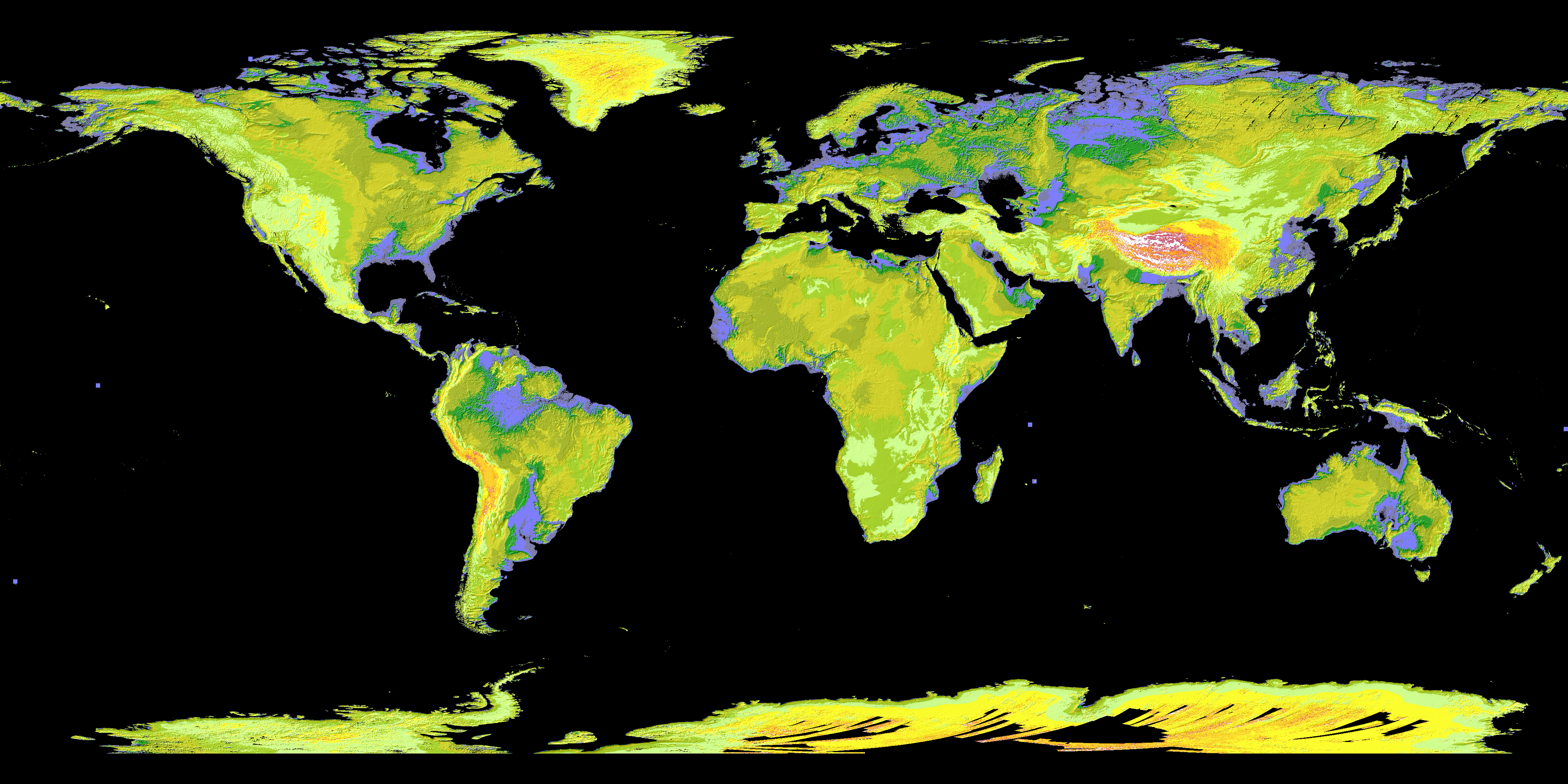
For people who love working with elevation data, we’re fortunate to have a pretty good collection of Earth DEM’s at this point! There are global DEM’s, provided by space-based instruments like the Space Shuttle’s SRTM mission that flew in 2000 and the joint NASA/Japanese mission ASTER that followed in 2003. And then there are local DEM’s, created by air-based LIDAR sensors, flown over areas of interest around the world. We even have satellites on other planets creating DEM’s of the Moon and Mars!
 NASA/JPL
Ok, back to Earth. We’ve got our planet’s landmass surface fairly well mapped out at a pretty good resolution. But what about the remaining 70% of our planet?
The Ocean
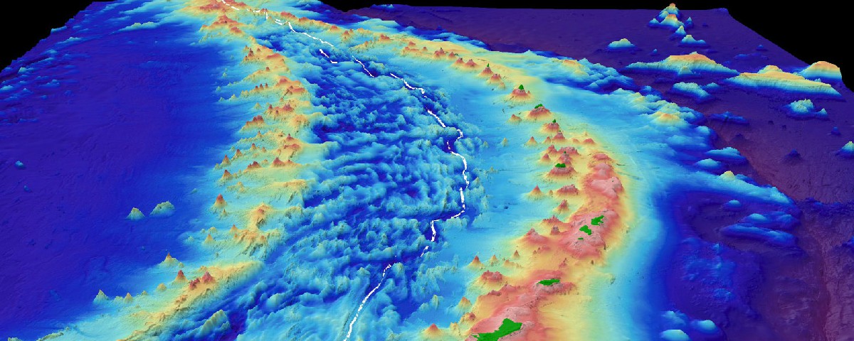
You know that pretty picture at the top of this post? Looks like an odd mountain range, doesn’t it? It’s actually elevation data from the Marianas Trench, 11 kilometers under the Pacific Ocean.
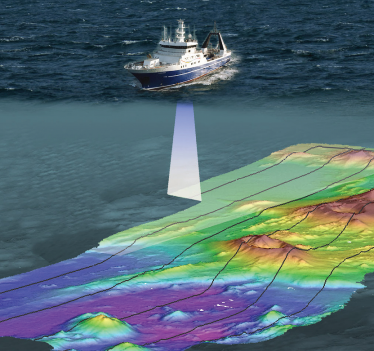
That elevation data was collected by deep-sea submersibles using multibeam bathymetry (MBB), a type of sonar that uses sound waves to measure the surface and features of the ocean floor.
 East Coast Lab
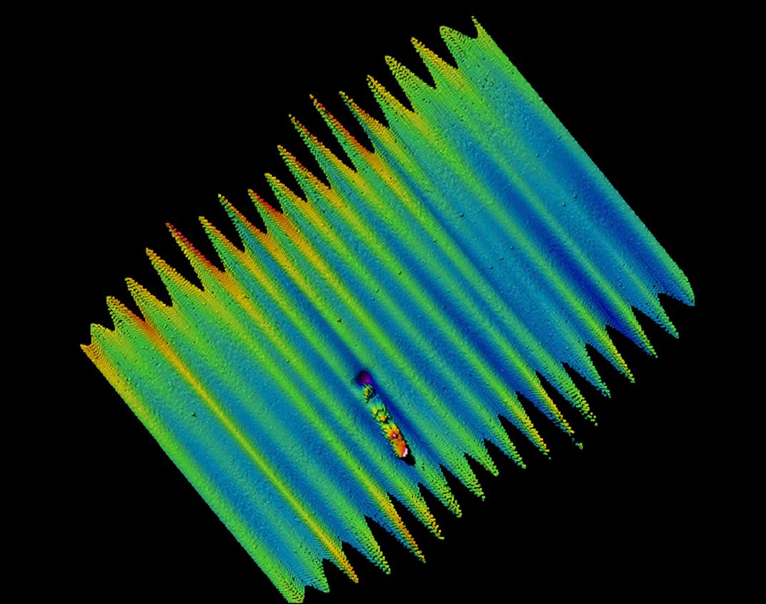
These types of systems can get down to 0.5-meter vertical accuracy on the ocean floor, allowing them to identify details of natural features like the ocean floor, as well as man-made features like shipwrecks.
 Smithsonian Magazine
OK, that’s pretty impressive! But what are some of the draw-backs?
Well, MBB is to the ocean as LIDAR is to the Earth’s surface. Even though they can provide very high-resolution elevation data of a localized area, it takes a lot of time to collect data over larger and larger areas. And when you’re talking about the ocean floor of the entire planet, it doesn’t get much bigger than that. And on top of that, operating deep-sea submersibles with MBB is even harder and more expensive than flying planes around with LIDAR.
Hmm, so taking high-resolution, localized measurements is really hard, especially deep in the ocean. Well, can we use satellites in space to measure the ocean floor somehow, just like we did with the SRTM and ASTER missions on the surface?
The Ocean Floor…From Space
It turns out we can! Historically, there have been two primary, space-based programs that have provided global elevation data of the ocean floor: the joint NASA/CNES Jason program and the ESA’s CryoSat program. Jason-1 satellite was launched in 2001, followed by its successor Jason-2 launched in 2012. And the Cryosat-2 launched in 2010 after CryoSat-1 was destroyed in a launch failure in 2005.
Both the Jason and CryoSat satellites use radar altimetry instruments, like the SRTM. But unlike the SRTM which measured land surface, these satellites measure the ocean’s sea-level surface height, a measurement also known as “ocean surface topography”. This data is used in studies on ocean circulation and sea-level rise, among other things.
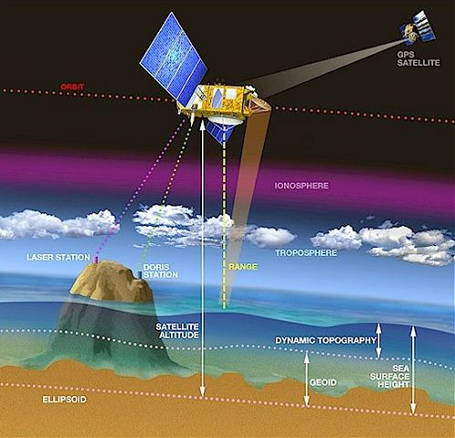 Altimetry
Unfortunately, when satellites take radar measurements of the ocean surface, there’s a lot of noise in the data, mostly caused by the chaotic motion of waves.

But if you take enough measurements over a long enough time frame, you can cancel out all of that noise, and then you’re left with a baseline measurement of the ocean surface.
But wait, a second. The ocean’s surface? I thought we were talking about the ocean floor?
Not Those Gravity Waves
From space, we use both light and radar to take measurements of the Earth’s surface. Lucky for us, they can both penetrate through our atmosphere relatively easily, although things like clouds can block light measurements temporarily.
But unlike the atmosphere, nothing can penetrate through water to the ocean floor all the way from space. Not light, not radar, nothing. So we have to be clever!
The ocean floor is made of rock, which is a much higher density than the water around and above it. Therefore, it exerts a bit of a gravitational pull on the water. Where there’s more rock, like a mountain underwater, it pulls more water to it, causing a slight bump in the ocean surface. Where there’s less rock, there’s less of a pull, causing a slight dip. And if we look close enough at the radar altimeter data of the ocean surface, we can pick out the slopes between the bumps and the dips. These slopes are what we use to create topography map of the ocean floor!
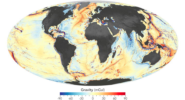 NASA/Earth Observatory
It’s a really clever measurement technique. Since we can’t measure something directly, we use measurements we can make, combined with knowledge about a secondary effect (i.e. gravity), to infer a new set of data!
The downside to the technique is that it’s not all that accurate. Did you think that estimating the height of rocks by measuring its gravitational pull through 11 kilometers of water was going to be accurate? The highest resolution of ocean floor topography we’ve been able to squeeze out of this method is about 5 kilometers per pixel. Comparing this to the 30-meter resolution of the Earth’s surface from the SRTM and ASTER data sets, it’s about 150x less accurate in horizontal resolution. So there’s still a bit of a ways to go!
Ok, so it’s less accurate. But I still want to use it for something. How do I get a DEM of this data?
GEBCO 2014
The General Bathymetric Chart of the Oceans (GEBCO) organization maintains a global DEM of the ocean floor. Its most recently updated data set, the GEBCO_2014, was released in December 2014.
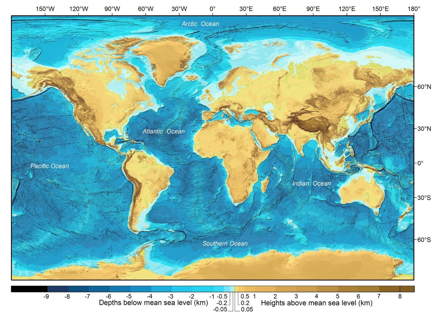 Wiley Online/AGU Publications
Arguably, it’s one of the most complete maps of the ocean surface that’s ever been compiled. Which is great! It’s a combination of “quality-controlled ship depth soundings with interpolation between sounding points guided by satellite-derived gravity data”, with a bit of SRTM data for land surfaces as well. Take a look at all of these different data sources that went into the GEBCO_2014 set.
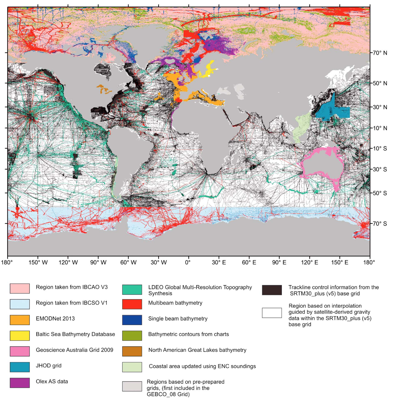 Wiley Online/AGU Publications
Hmm. It looks like there’s pretty good coverage globally for near-shore waters using various bathymetry techniques. But for the deep-sea areas, the vast majority of the data in the GEBCO_2014 comes from the much lower resolution, satellite-derived gravity maps. As for the modern, high-resolution multi-beam bathymetry data, there’s mostly just coverage along the coasts of Antarctica and in the Greenland Sea, likely a result of concentrated efforts to measure and monitor sea-level rise due to climate change.
Ok, so other than monitoring sea-level impacts due to climate change, why do we need more high-resolution data for the deep sea ocean? Well, there’s also uses in finding shipwrecks, marine conservation efforts and tsunami forecasting, to name a few.
But what about finding missing airliners?
MH370
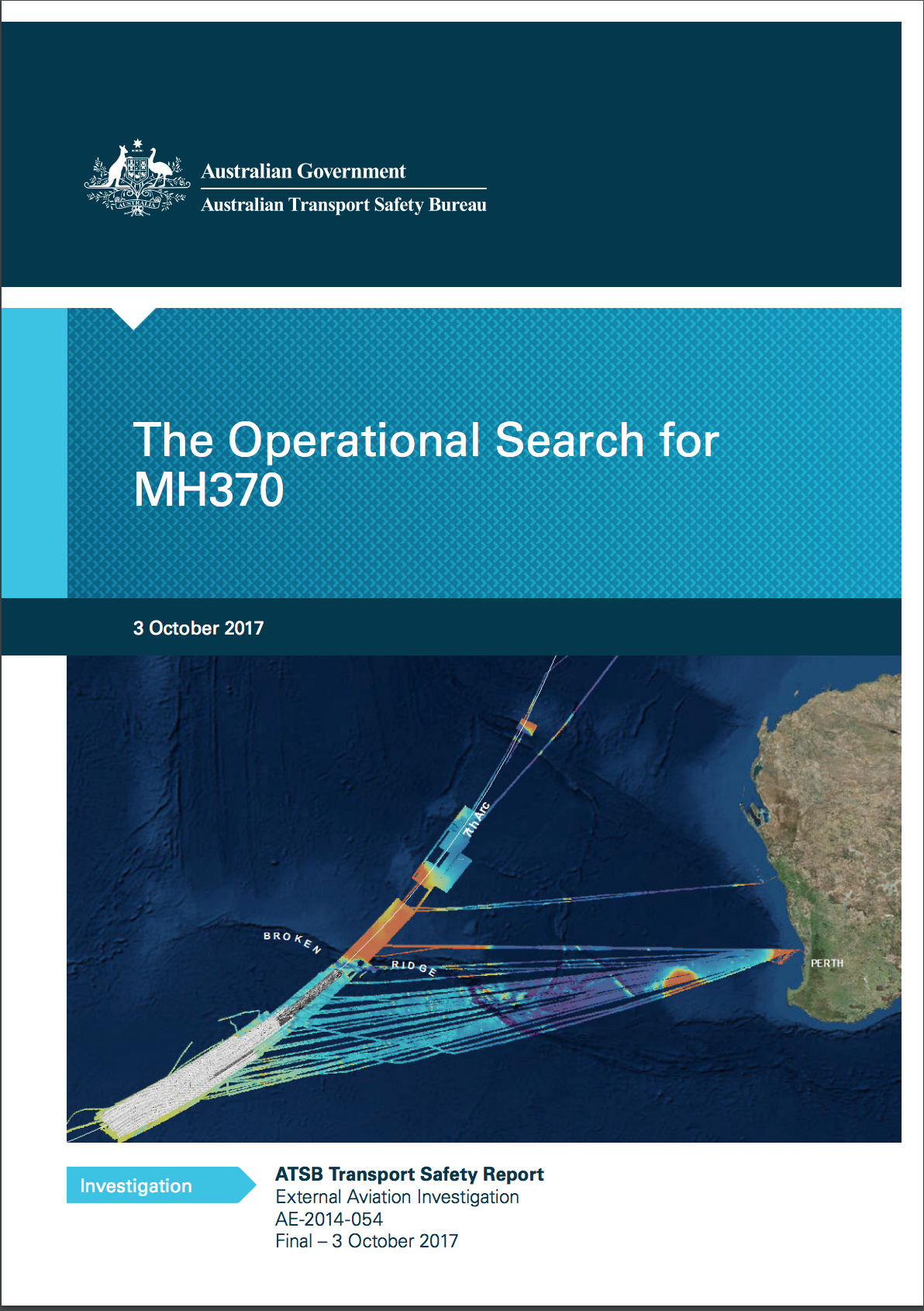
Flying from Kuala Limpur to Beijing on March 8, 2014, Malaysian Airlines Flight 370 (MH370) disappeared with 239 people onboard, launching an international search effort and prompting the still unanswered question of how an airliner goes missing in the modern world.
A few weeks after the airliner went missing, the Australian government offered to take the lead in search and recovery operations in the South Pacific ocean, under the direction of the Australian Transportation Safety Bureau (ATSB). While the search was suspended in January 2017 after unsuccessful efforts to locate the missing airliner, the ATSB has provided multiple, detailed reports about the search operation efforts.
ATSB Operational Search Report
 Australian Transport Safety Board
I highly recommend reading in particular the final operational report dated October 3rd, 2017. It covers a lot of fascinating details about the search, including the following:
- International coordination of search efforts
- The geolocation technique developed on the fly by Inmarsat using aircraft-to-satellite communications
- The massive scale of effort that went into doing towed sonar scanning (including a list of commercial companies involved)
- Lessons learned from the search for the Air France Flight 447 that crashed into the Atlantic Ocean in 2009
- The attempt to geolocate the plane crash using hydroacoustic monitoring data provided by the Comprehensive Nuclear-Test-Ban Treaty Organization (CTBTO)
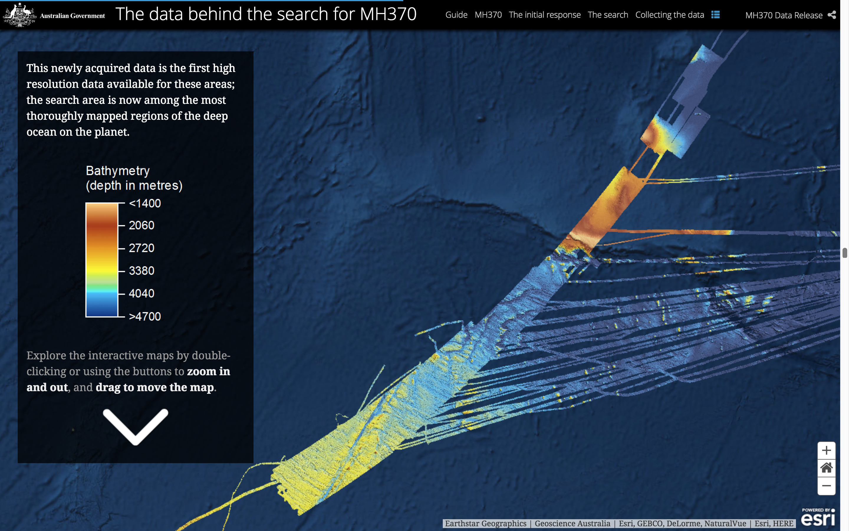
The Australian government published a visualization of the search effort to provide a high-level overview of all that was involved in the operations.
And considering the huge logistical cost involved in the search operations, as well as the fact that it was ultimately fruitless, the ocean floor survey data that resulted from the search efforts have provided scientists with a wealth of geological insights into that particular region of the ocean, including information on ocean tectonics and seafloor erosion.
 Australian Transport Safety Board
Seabed 2030
While the need for detailed ocean floor mapping has been known in the scientific community for quite a while, the effort and drama of the search for MH370 brought the need for high-resolution ocean mapping into the public eye. One recently launched international effort to provide such maps is Seabed 2030, a collaborative project between GEBCO (discussed above) and the Nippon Foundation, a Japanese non-profit organization.
Seabed 2030 intends to combine and coordinate detailed bathymetry measurements to create a global ocean floor map, with an ambitious roadmap to accomplish its goals within twelve years. Such a map would provide significant insight into a number of human endeavours, including navigation, climate change monitoring, tsunami warnings and even commercial mining.
The project was declared operational in February 2018 and it will be interesting to watch the it unfold. With a herculean task of coordinating such a large number of ships, technologies and hours involved, it remains to be seen how successful such an effort will be.
The Final Frontier?
Some people argue that we know more about other planets than we do our own planet’s ocean. Which is kind of true! But the ocean is a feature unique to planet Earth as far as we know. And in some ways, going deep into the ocean is even harder than going out into space oddly enough, making it a long-standing unexplored frontier.
International efforts like Seabed 2030 are an important part of continued exploration and understanding of our planet. And the new maps that they aim to create will help countless human endeavors and unlock new opportunities, not unlike the current mapping revolution that is happening on land.
Ad Oceanum!
Additional Reading
- Exploring Ocean Tectonics from Space, University of California - San Diego
- Mapping the Seafloor with Gravity Models, UNAVCO
- “A new digital bathymetric model of the world’s oceans” by Weatherall et al, AGU, August 2015
- “Why Haven’t We Explored the Ocean Like Outer Space?” by Sarah Emerson, Motherboard, June 2016
- Posted on:
- July 24, 2018
- Length:
- 9 minute read, 1828 words
- See Also: